Cascade Alpinism

Cascade Alpinism

Wednesday, August 21, 2024

Raging in a Day - 08.21.2024

    So two weeks ago I had the grand idea to ride all the important trails at Raging River. In a day of course because why not, I probably had the fitness. Previous to this, my longest ride had been just barely over 5000’ but 7000’ shouldn’t be that bad. I was just adding No Service, Physical Therapy, upper ET, and lower Ferdinand the Bull. So maybe more like an extra 2.5k but why not. 

I left seattle at 07:15 and was at exit 27 by 07:45. I pulled in next to a lady I knew from outdoors for all, exchanged plans, and after some valve core troubles, was off by 08:30. I made good progress up the road feeling good. After stashing a bottle at the road turnoff by poppin’ tops, I grinded it out to the top of No Service and arrived at 10:15. I was feeling great and enthused for the long day ahead of me.

There had been recent rain so No Service was super fun. It was a little slick in spots and at one point, I crashed on my side but it was painless. From here I vowed to take it easy on the trails. It would suck if I had to bail the ride if I crashed badly on the second to last run. I started the climb up Return Policy and was still feeling awesome. After a short break in the middle, I hit the top at 11:30. 

CC downhill ran great. 2000’ of descent will always be brutal yet fun. Like No Service, it was slick but manageable, and I always got a shower when I brushed against branches. The climb up raging tiger was much longer than I remembered but I got to the road at 12:30 and took a break while replacing my water bottle with a full one. 30 minutes of steep suffering up the fire road section of RR2, I was at the top of Reverance at 13:00. 

Reverence was easier than the last time I’d rode it. By now, my legs were feeling it but I was still able to keep a reasonable speed. The flow section in the middle felt amazing and while I still made a few mistakes, I survived it unscathed. This was the climb where I finally felt it badly. I stopped 3 times on the way up to the fire-road and it was 14:45 when I made it to the top of PT. Here I took a break and saw the lady from ODFA. She was coming back from No Service and I envied how she just had to do poppin tops and she’d be back at the Car.

PT was super easy and at 15:15 I was again at the bottom. Now all I had left was ET. The techy climb up Pacific Climbing Trail was brutal with my shot legs but by 15:45, I was at the top. With legs of jello, I couldn’t pedal much on the descent, but made it down the flow section, where I traversed over to lower Ferdinand and had a great time on the easy Tech. From the bottom of Ferdinand, I climbed back out and was power-napping on the bench above poppin tops at 16:15. 


Realizing I still had to do ED.

Poppin tops is a great trail but not this time. Upper was admittedly fun but from there, I just wanted to be done. Luckily, it’s all downhill from there and after some sitting on the saddle for lower Poppin tops, I pulled into the lot at 16:30, just as the post-work riders were arriving. It was a mega-fulfilling day and a reminder that big MTB days are possible.

But... maybe I'll reserve type-2 fun for climbing and let biking just be a chill thing.


Sunday, August 11, 2024

Nooksack Tower - Beckey-Schmidtke - 08/11/2024


Alpinism has always been what I dreamed of pursuing. The alpine rock of this summer has got me close, but Nooksack tower confirmed my alpine ambitions. It's got a cascadian approach, some glacier slogging, steep snow climbing around bergschrunds, and finally alpine rock on top. And of course like any alpinism objective, there was endless suffering. I first saw Nooksack tower in my Nelson-potterfield book and was quickly fascinated by its striking character. With exposure on all sides, it begs for climbers. With a little beta from CascadeClimbers, Cole picked me up at the yarrow point station and we were off. We picked up some rappel rings, webbing, and a rope at the AAI shop in Bham before driving towards nooksack cirque TH.

My first true taste of alpinism

After sleeping in, we left the trailhead around 09:00. We took the wrong route along the creek but were quickly onto the old railbed, where the endless trail continued until we got to Nooksack river. The tree crossing from the year before was gone, so we bushwacked along the river to the normal ford. Cole went first, bringing the rope so we could set up a tyrolean for the packs. Giving the packs a dip, I completed the nut-freezing ford and put the heavy and now-wet rope back on my pack. So much for dry-treatments.

A shitty tyrolean + my pantless legs

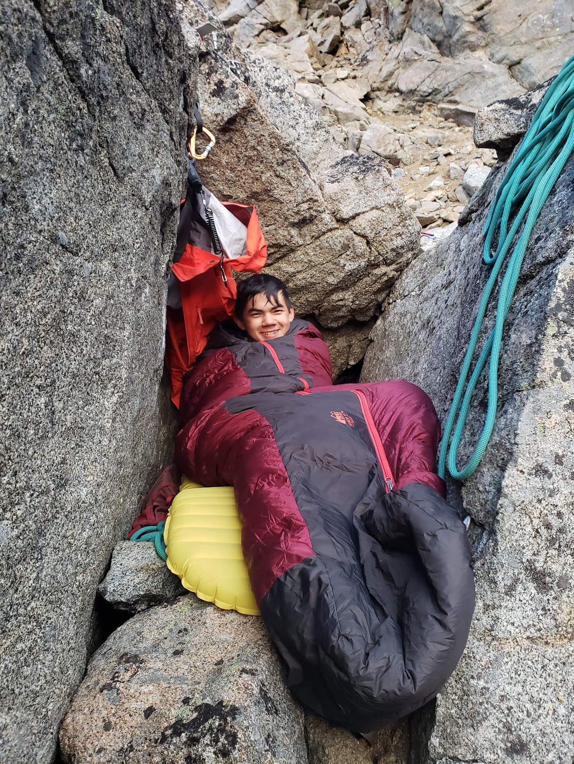
Once across the river, we schwacked for hours, eating blueberries on the way. Eventually we reached the moraine, but quickly headed up some vertical schwacking to gain the ridge. From there, we traversed until we reached the rock slabs around 04:00 but with thunder nearby, we decided to set up a bivy and not go any higher. It would mean an extra 500 feet the next morning but we didn’t wanna risk it with the storms. It was a stunning, flat bivy with views of shuksan and the surrounding mountains. I was worried about the precipitation on my down bag but we were lucky and it missed us, with mosquitos attacking us instead.

Good old schwackin

A beautiful bivy

We got going at 04:00 on saturday morning, prepared for a long day ahead of us. We quickly reached the 5900’ notch and descended onto the glacier with one rappel. From there we slogged after end-running a crevasse and after climbing over a snow-filled gaper, we were at the base of the steep snow by 06:00. Simul climbing with 4 pickets, we reached the top of the snow gully by 08:00 with the snow reaching 65 degrees near the top. 

Cole Climbing up the final pitch of snow

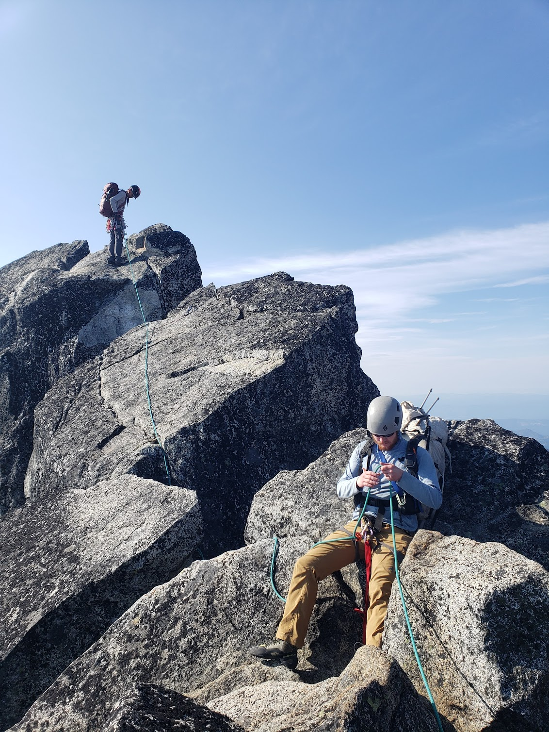
After stashing the snow gear, I led the first pitch, over the chockstones in the right chimney, then a quick rightward traverse and up the easy slabs. From there, we took in coils to simul. There was very sparse protection and lots of loose rock. We gained the false ridge and worked our way up the gully, trying not to throw rockfall onto eachother. At one point, I kicked off a piece that hit coles backpack after he covered from my “rock” call. We worked our way left once possible, crossing a few ribs before reaching the summit around noon. It is certainly solo-able but the sheer amount of loose rock was unnerving. There were many death blocks precariously balanced, ready to fall from any force.

Runout exposed choss

Cole leading a pitch

At the summit, we relaxed a bit before starting our rappels at 13:00. We backed up the rats nests and worked our way down with many double rope rappels, commonly getting the rope stuck during the pulls. On the final rappel down to snow, the rope got so stuck that the 3:1 wasnt getting us anywhere. Cole started jugging up the rope but 3 feet off the ground, it went loose. In hindsight, we should’ve done a 9:1 before considering jugging. Once we retrieved the ropes, we discovered Cole’s rope was coreshot from the pull. We still trusted it for rappelling but with the exposed core, it would have to be cut down after. By now, it was past 16:00 and we still had a lot of snow to get down. We cut some snow bollards into the moat and worked our way down the gully. Even after loosening the rope after the first rappel, we still had to use a microtrax to haul and retrieve the ropes after each rappel. By 18:00, we were down-climbing around the crevasses and after a quick slog and some exposed low 5th class scrambling onto the ridge, we got to camp at 20:30, 16.5 hours after leaving camp and 7.5 hours after starting the descent. We quickly scarfed down some food and got to bed.

On the summit with Shuksan in the background

Summit register

Bomber 2 nut anchors

Almost done with a long-ass day

The next day we woke up at 08:00 and were going by 08:30. Other than getting stung by a bee, the reproach was largely uneventful. The tyrolean went quicker, we were too lazy to take anything off for the river crossings, and we were back at the car by 12:30. All in all, it was an amazing trip into the alpine, and while we definitely complained about it a lot, it was my raddest alpine adventure and already has me excited to keep climbing.

Tuesday, August 6, 2024

Mount Stuart - Complete North Ridge - 08.06.2024

 The Complete North ridge of Mount Stuart is likely the most famous alpine rock line of washington state. The bold route, named in the 50 classic climbs of North America, stands out on the North side of Mount Stuart, splitting the Ice Cliff and Stuart glaciers with more than 3000’ of granite, which some scientists believe came from Mexico. If only it had come a little closer to one of the main highways.

The complete north ridge in the skyline from the north ridge of sherpa

The complete north ridge is the obvious ridge in the center. Taken from the summit of Colchuck Peak.


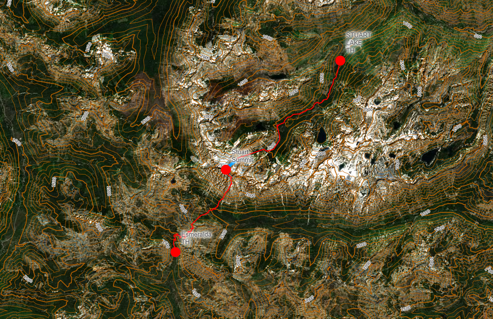
The Car logistics of stuart are super tricky, if coming in from the north it’s easier to get to the climbing, but you then either need to rappel down the ice cliff glacier(bringing snow/ice gear) or go through sherpa Col, which entails a lot of extra walking. You could also go from the south, but that requires a tricky traverse around the west ridge and a long approach. We opted for the rarely done option 3, car shuttling. While definitely time and gas consuming, it made the whole climb much more straightforward. We started at Stuart Lake TH and finished at the Esmeralda TH.

Red: hiking                  Blue: Climbing

On Sunday evening I drove up to meet Emily at the Esmeralda TH. I put my expired forest pass on the car, and we drove off towards Leavenworth. We arrived at Stuart Lake TH around 8 to sort out gear and get some good sleep. I cowboy camped in the parking lot with a creepy deer while Emily enjoyed the luxuries of her car sleep-setup. At 04:00, our alarms rang and at 04:30 we were off. Since we had done the mountaineers creek approach the week earlier, we knew we could always traverse the talus field, but from other trip reports, we wanted to see if we could find the trail along the creek. It can be found by turning downhill and following the cairns once you reach the entrance to the boulder fields. Once you're along the creek follow the trail and if you ever lose it, just keep walking and you'll find it eventually. It always sticks between the talus and the creek so you won’t ever be far from it.


We eventually started our trek up towards the Stuart basin. We grabbed water in the trees to the left about 100 yards before they ceded to the boulders. From here, the north ridge was obvious and we began our slog up to the moraine. Once on the moraine, it was a quick walk to the toe, where a pitch of class 4 climbing awaited before the last obvious belay ledge. We arrived at the little ledge and gladly unloaded our packs around 09:00, about 4.5 hours after leaving Stuart Lake. Emily took the first pitch, getting the packs stuck while trying to haul them past the squeeze chimney. We also broke a trigger string on a Metolius ULMC #3. Nice training wait I guess. It was nice we had doubles. The second pitch can easily be linked with the first if you have a 60m rope but I guess I should’ve looked at more beta before, since I wasted a few minutes wondering if I was done after the 20m of climbing. It might be hard to haul packs  if linking these up though, since it’s a little wandery and there were numerous places for packs to get stuck.


The third pitch is the crux by far. It was Emily’s lead, but she ended up aiding a good bit of it. If this is near your limit, I highly recommend at hauling the leaders pack, I was able to follow on TR with my pack on, but as a novice trad climber, the 5.9+ was definitely pumpy. From there, we switched to simuling and tried to make good progress. We had to pitch out a few little crux sections, still moved fast. Having a micro-trax for each person on this route is super helpful. They’re great for hauling packs, belaying people up rope-draggy sections, and fall-proofing simul cruxes. This first simul block was fun, with lots of optional route options to spice it up. You often aren’t within earsite so radios are highly recommended.

Emily following up a simul block

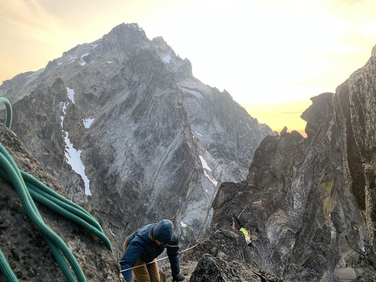
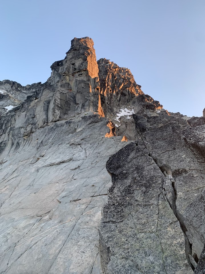
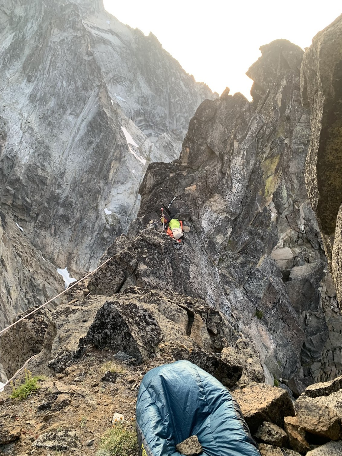
After 7ish hours of simuling, we reached the slab with the crack pitch. It’s kind of cool I guess but it’s honestly a bit overrated in my opinion. After leading it, we found two bivy ledges 60m below the great gendarme. It felt great to take the packs off and get some food in my stomach. Since my ledge was slanted outward, I tied in and tried to go to bed. It was hard to close my eyes though, since everytime I opened them I’d be looking at the great gendarme and my 5.9 lieback to start the next day. Eventually I got to bed, waking up every hour to readjust and stop myself from rolling off. 

A view of the great Gendarme from my bivy

I was awakened the next morning by mosquitoes attacking me. While all I wanted to do was cuddle up in my bag against the cold morning air, I had to swat a skeeters trying to eat me alive. When Emily woke up and said we should get going, I didn’t disagree. She led the slab up the base of the great gendarme, with me having to go on simul for the last 20 meters. At the base, I racked up and tethered my pack, intimidated by the 5.9 lieback. It went much easier than expected though. There were rest sections every couple moves and I never got pumped tryna place gear. At the top, I brought the packs and Emily up, and she started up the offwidth. After french freeing it(thanks to our #4, worth the weight), she brought me up to a good belay alcove. 

Emily Following the Lieback

me at an airy belay ledge


To go from there, we had to descend a little bit to traverse over to the notch. I had too much rope-drag and had to stop at the Bivy ledges before the notch. We climbed over a gendarme, having to rappel it to finally get to the last crux, a great 5.8 finger crack. For other parties, take the downward ramp at the Bivy ledges, even if it seems like it goes too far down, it’ll avoid an unnecessary rappel. Emily again french freed it and I led one long simul block to the summit. We topped out 50 feet from the summit, put away the rope, and at 11:00, completed our climb of the north ridge of Mount Stuart. After a few summit photos, we started our descent of the Cascadian. It’s not hard to get over to it, just follow the cairns and don’t go down the obvious couloir you see from the summit. It’s hard to imagine, but that somehow gets worse than the Cascadian.

On the summit

While annoying, the Cascadian descent was pretty straightforward. It was nice to have a trekking pole for the scree skiing but other than that, it’s just a lot of sand in your shoes and cursing at yourself for choosing this sport. Jimmy Chin said in Meru that “the best alpinists are the ones with the worst memories”. While I’m still waiting to do Nooksack tower this weekend to call myself an alpinist, I totally agree with this sentiment. I keep thinking to myself as I write this how the Cascadian wasn’t that bad. Similar to how I already wanna try glacier peak c2c, even after the 18 hour push from camp-summit-car. A bad memory isn’t terrible. As long as it doesn't kill me, It keeps me pushing myself.

    Once at Ingalls creek, we decided we didn’t feel like climbing Ingalls peak. While we had the energy and it was totally do-able, it felt anticlimactic. We’d just completed the biggest alpine rock route in the state, and now we were gonna climb this red piece of rock? It was like trying to bag little T after Rainier. We also joked about just hiking out the Ingalls creek trail to US 97 like on sherpa. Luckily we actually had a car this time. My car was a great sight. We reversed the car shuttle to come across Emily's ticketed car( a FS employee who doesn’t have a NW forest pass) and I was back in Seattle around 10:00. By the time all my gear was inside, I was already thinking about when I’d climb it again.


Sunday, July 28, 2024

Sherpa Peak - North Ridge - 07.28.2024

 I’m not sure how I feel about the north ridge of Sherpa. The climbing wasn’t spectacular and I honestly could’ve simulated the whole thing. The approach and exit were fuckin terrible. But at the same time, it was an unforgettable experience, and those attributes made it unequivocally Cascadian.

The original plan was  to link up two routes on Vesper, mile high club, and Mt Triumph all into a 3 day weekend. The Easy fire on Hwy 20 quickly foiled that plan since emily lives in Mazama so we instead chose to meet up in the stuart range. Me and emily would climb on the snow creek wall on friday, and then link up the North Ridge of Sherpa and the South Face of Argonaut. I don’t have a ton to say about snow creek wall. We climbed outer space, saw a mountain goat, and then got out at noon. On friday evening, we met cole in town to discuss plans.

Emily on Outer Space

Our plan was to climb the North Ridge of Sherpa on Saturday, descend and Bivy and sherpa col that evening, then climb the east ridge of argonaut to the south face. We aimed to get back to the car by 3 so cole could make his doctors appointment in seattle at 7. Since we knew there’d be snow at sherpa Col, we brang a stove and enough fuel to melt snow for 3. We drove to our communal vacation home (forestlands parking of course) and set alarms for 04:30.

The North Ridge of Sherpa Peak with the East ridge of Argonaut behind, taken from the North Ridge of Mt Stuart.

By 05:30 we were off on the stuart lake trail. It’s one of the busiest trails in washington and while that makes it horrible, given that we’d only be on it for an hour, I decided to at least have some fun with it, trying to pass as many people as possible. It’s quite fun to pass trail runners while carrying a 35 pound overnight climbing pack. Similar to the feeling you get passing E-bikers on “analogue” bikes, though at least these trailrunners are abiding by wilderness regulations so I don’t feel a dislike for them.


After a little walking past the colchuck lake turn-off, we reached the mountaineers creek climbers trail. It was our first time and we made the mistake of following the cairns to traverse the talus field. Then, we were too high and were stuck either schwacking through slide alder or climbing a few hundred feet above the slide alder. By now we were past our estimated approach time, and we still couldn’t see the ridge. We eventually made it up into the sherpa-argonaut basin, about 4 hours after leaving the car. From here we could see the notch we would gain to start the north ridge, and I think that’s when we all realized we were in for an epic. After more than a thousand feet of talus field climbing in the sun, we racked up and flaked the ropes at 11am.

Sherpa-Argonaut basin, with Colchuck(left) and Argonaut(right) in the skyline.


The first two pitches to get to the first notch were the technical crux of the route, but they allowed us to get our heads in the game and figure out the rope system for 3 people. From the ridge, we began a long afternoon of pitching out the ridge mixed with soloing and a little simuling. We found Lemke’s beta about getting to the second notch and by the time we got there, it was 6pm and we figured it would be the best spot to bivy. We were well behind schedule and doubted our chances of getting argonaut. With the sunset winds at full blast, we made our meals, did our best to shelter from the winds, and tried to doze off. Watching a party make their way up the West ridge didn’t help us get to sleep any faster.

Cozy in my protected bivy

And Cole’s not so protected Bivy

At sunrise, we woke back up and got into a groove. The pitches from here were much better. While still licheny due to the routes rarely climbed status, it felt much more solid and after four hours, we topped out. With Stuart to the West and Argonaut to the East, it was beautiful summit. 

On the summit

The descent was the true crux of the route. We got to Lemke’s “cascadian esq gully” but after seeing the traverse we’d have to do, Cole gave us another option- descend into ingalls creek and follow the trail to us 97, where we’d hitch a ride back. After underselling us by 4 miles on the mileage, we were convinced and proceeded to schwack down to the creek. After 2 hours of talus descent and bushwack, we hit the trail around 2pm. This was when Emily checked the actual stats of the trail, about 9 miles of hiking plus 2 miles of road walk. We realized how fucked we were but there was nothing we could do, and proceeded to slog. 

The Cascadian-esq gully

At 6, me and Emily came out far ahead of Cole, deciding to try and hitch a ride back so we could pick up Cole if he was unable to get one. We rode in the back of a truck to the highway, and then proceeded to fail to hitch a ride for 20 minutes. Eventually, we were picked up and were lucky enough to get a ride all the way back to forestlands. We met Cole in town, who had paid two crackheads to give him a ride, and enjoyed the experience of coming back from an epic adventure into the tourism center of Leavenworth, a stark juxtaposition every time.


Tuesday, July 23, 2024

Colfax Peak - East Ridge - 07.23.2024

 Emily had mentioned Cole while climbing together and noted how I’d like him. Eventually, she gave me his number and we figured we’d do East ridge of Colfax Peak together to see how we vibed. Cole had just done the North Ridge of Baker two days earlier so it was convenient for him and I was excited to do some snow climbing rather than rock. Cole mentioned he had gotten out of shape in colorado and I wasn’t feeling like suffering so we decided to split it up into a mellow two days. I drove up monday morning and met Cole in B-ham where we grabbed some groceries and headed up to heliotrope ridge TH. the road is a classic FS road and after hundreds of potholes, we arrived.


Baker is the big snowy thing on the left(the north ridge in the left skyline), Colfax is the smaller rocky thing on the right.

The Hike in was quick. The trail is steep but we quickly arrived at our camp, overlooking the baker seracs. Since we had lots of time and didn’t want to get attacked by mosquitos, we decided to do some serac cragging with our four Ice screws. I had just got quarks so it was exciting to actually climb ice with them. I toproped some AI3, we did some laps, and then headed back up to camp. I made the mistake of not bringing a mosquito net(I don’t have one since I don’t consider them ‘sexy’ pieces of gear) so after some quick dinner, we tried to get an early sleep, aiming for a 3:30am wake up. Cole used his phone for the alarm and I woke up at 05:00. Apparently Cole just wanted to sleep in. Given that Colfax is a pretty chill peak, I was fine with it and we got going by 05:15.


After an hour of hiking, we got to the snow. The Slog up the Coleman was hot but easy. We brought skis to make the way down quicker but even with that added weight, we were at the col by 09:00. After simuling a steep snow traverse over some crevasses, there was a short steep snow pitch and we topped out at 11:00. We took a five minute break, then decided that it was kind of windy and started our way down.


Traversing


On the summit

The way down was pretty uneventful. We descended before corn-o’clock so it was brutal on the legs but we were at camp by 14:00. After stopping at camp, we blitzed down the trail passing hikers. At one point a group of hikers got out of the way for us but directed us toward the toilets. After joking that they must’ve thought we were two horny gay mountaineers, we climbed back up to the trail and made clear our straight-ness before continuing and arriving at the car at 15:30. 


Cole skiing suncups

All in all it was a great chill two days in the alpine. Cole and I got along well and have since become regular climbing partners. Hopefully I can come back one day to climb some of those hard ice routes on Colfax.


Friday, June 28, 2024

Cutthroat Peak - South Buttress - 06.28.2024

 So this was pretty long ago and I’m not gonna delve too deep into it but I figure that I might as well write a small little report about it. Emily and I had skied the Colchuck Glacier some time ago and she decided to get me into alpine climbing. I drove up there friday morning and we set off for Cutthroat at around 08:00. The approach was simple and son we were climbing up the approach gullies. They were loose but soon we were near the top, where we roped up for the pitch to the top


Once at the ridge it was pretty smooth sailing to the top. There was a fun crack pitch somewhere in the middle, and to finish it off, a nice offwidth that put us on the summit. Since it was my first alpine climb, it was an entirely new experience for me and got me hooked. The views were great, and clear skies opened up the north cascades.

The descent down the west ridge went easy. After some scree skiing, we reached the basin where an hour of hiking brought us to the car.


Thursday, June 13, 2024

Glacier Peak - Suiattle Glacier - 06.13.2024

 Day 1

I’ve been putting off writing this trip report for a while but with school now starting, I figure it’s a good time. Glacier Peak is probably the hardest Volcano in the state. With a horrible approach and it’s wilderness nature, most parties do it in three days. Keenan and I planned to make the most of the alpine snow by hitting it as soon as we got out of school. The approach consists of 13 miles of walking along the North Fork Sauk river and 4000’ of climbing up to white pass. Because of this, we planned to do it as a three day trip, giving us a somewhat relaxing schedule.

Glacier Peak

Keenan picked me up in Seattle at 07:00 on Thursday and by 10:00, we were at the trailhead with our loaded 55lb packs. As we started up the trail, minimal blowdowns let us keep a good pace along the river. We ran into 3 parties who summited the day before, exchanging reports of great alpine conditions. As the switchbacks started, Keenan slowed but we still maintained a good pace. Halfway up the switchbacks, military planes came soaring close above us. It’s pretty surreal being far out in the wilderness when these modern planes come sweeping above the treeline. 2000’ of switchbacks, we got to the traverse over to White Pass, where many snow patches slowed us down and wet our socks. Cute marmots on rocks made it tolerable.

Marmots chillin on the way up white pass

At 16:00, we arrived at White Pass. Skinnable snow started here and we put on skins to traverse over the rest of Marmot Knob. Taking the boots and skis off our packs made them feel luxuriously light, even though they were still a solid 45lb. From there we skied into the basin our whole world turned into snow and rock. It’s a surreal feeling, being in such an enclosed alpine environment, and one I hope to experience more. At 19:30, we decided to call it a day. Our reasons were that we’d be able to go about our camp rituals in the light, It’d give us more time skiing without overnight packs, we were near a nice bivy spot, and obviously we were tired

Keenan in the basin

Me and Glacier Peak

Setting up camp went smoothly. The snow was great for ski anchors and while our tent was cozy, it still provided enough space. After some quick water boiling and a great mountain house dinner, we tucked ourselves away in preparation for an early start the next morning. Forecasts showed lots of new snowfall the next night so we decided to move camp to white pass the next day.With alarms set for 01:30, we readied our bags and tried to get some rest.

Day 2

01:30 came quickly. After some oatmeal and piling some snow on the tent to keep it from blowing away, we were skinning by 02:00. Getting to Glacier Gap went quickly and we were soon descending onto the Gerdine Glacier as the first traces of light shown across the horizon. There were clouds down low but we could see the peak and hoped for a beautiful day. From here, we skin up to Disappointment Col was sloggy but beautiful. Keenan started to drag behind but we continued upward. At Disappointment Col, my bowel system started to act up. With gusts of 30mph, I got out the wag bag. You can probably imagine the struggles without me describing it but needless to say, I was glad it was all out and it wasn’t an experience I’d like to repeat.

Glacier Peak from Glacier Gap Peak Col

Keenan working his way up the glacier

Above us was clouds but with a long time until our turnaround we continued up. Once we made it to the Disappointment-Glacier Col, we found ourselves in a brutal wind tunnel. Scared at the thought of booting up with sails on our backs and skiing down ice with brutal gusts that had the potential to knock us over, we left our skis at the Col and booted up. Within an hour, we were on the summit in a whiteout.

It got pretty cold, me in my alpine action suit

Final few feet to the summit

Summit Selfy

After a few summit photos, with knowledge of the rest of the day, we quickly descended down to our skis. Since the sun didn’t come out, the skiing was icy and slow. However, it was still faster than walking and we got down. After a boot back up to glacier Gap, it was a quick ski back to camp. We packed up quickly and with heavy backs, started the skin back to White pass at 14:00. The slope up to the Marmot Knob traverse was brutal, but at 16:30, we got to white pass.

Keenan doing some shitty skiing

At white pass, we decided to get all the way back to the trailhead. Though it would’ve been safe to camp there, the next day would be very wet and rainy. We decided instead to try to make it all the way back to the trailhead. We turned our heads down and worked our way down white pass. The descent went quicker than expected and from there it was just a long walk out. We made a great pace and while the last mile felt endless, got out at 21:30 to the cars. Here we discovered a flat tire and after being harassed by mosquitos,  started the drive back. 

Almost to white pass

Glacier Peak truly shows Washington's wilderness. I can’t imagine another place in the lower 48 where one can feel so separated from civilization. I’m profoundly grateful to live in such a beautiful state and hope that many of my friends can one day share similar experiences.


Summer climbing.

 Theres a bunch to write about. And for one reason or another I haven't been writing about it. Coming out of school, the first week went...