
I’m not sure how I feel about the north ridge of Sherpa. The climbing wasn’t spectacular and I honestly could’ve simulated the whole thing. The approach and exit were fuckin terrible. But at the same time, it was an unforgettable experience, and those attributes made it unequivocally Cascadian.
The original plan was to link up two routes on Vesper, mile high club, and Mt Triumph all into a 3 day weekend. The Easy fire on Hwy 20 quickly foiled that plan since emily lives in Mazama so we instead chose to meet up in the stuart range. Me and emily would climb on the snow creek wall on friday, and then link up the North Ridge of Sherpa and the South Face of Argonaut. I don’t have a ton to say about snow creek wall. We climbed outer space, saw a mountain goat, and then got out at noon. On friday evening, we met cole in town to discuss plans.
Emily on Outer Space
Our plan was to climb the North Ridge of Sherpa on Saturday, descend and Bivy and sherpa col that evening, then climb the east ridge of argonaut to the south face. We aimed to get back to the car by 3 so cole could make his doctors appointment in seattle at 7. Since we knew there’d be snow at sherpa Col, we brang a stove and enough fuel to melt snow for 3. We drove to our communal vacation home (forestlands parking of course) and set alarms for 04:30.

The North Ridge of Sherpa Peak with the East ridge of Argonaut behind, taken from the North Ridge of Mt Stuart.
By 05:30 we were off on the stuart lake trail. It’s one of the busiest trails in washington and while that makes it horrible, given that we’d only be on it for an hour, I decided to at least have some fun with it, trying to pass as many people as possible. It’s quite fun to pass trail runners while carrying a 35 pound overnight climbing pack. Similar to the feeling you get passing E-bikers on “analogue” bikes, though at least these trailrunners are abiding by wilderness regulations so I don’t feel a dislike for them.
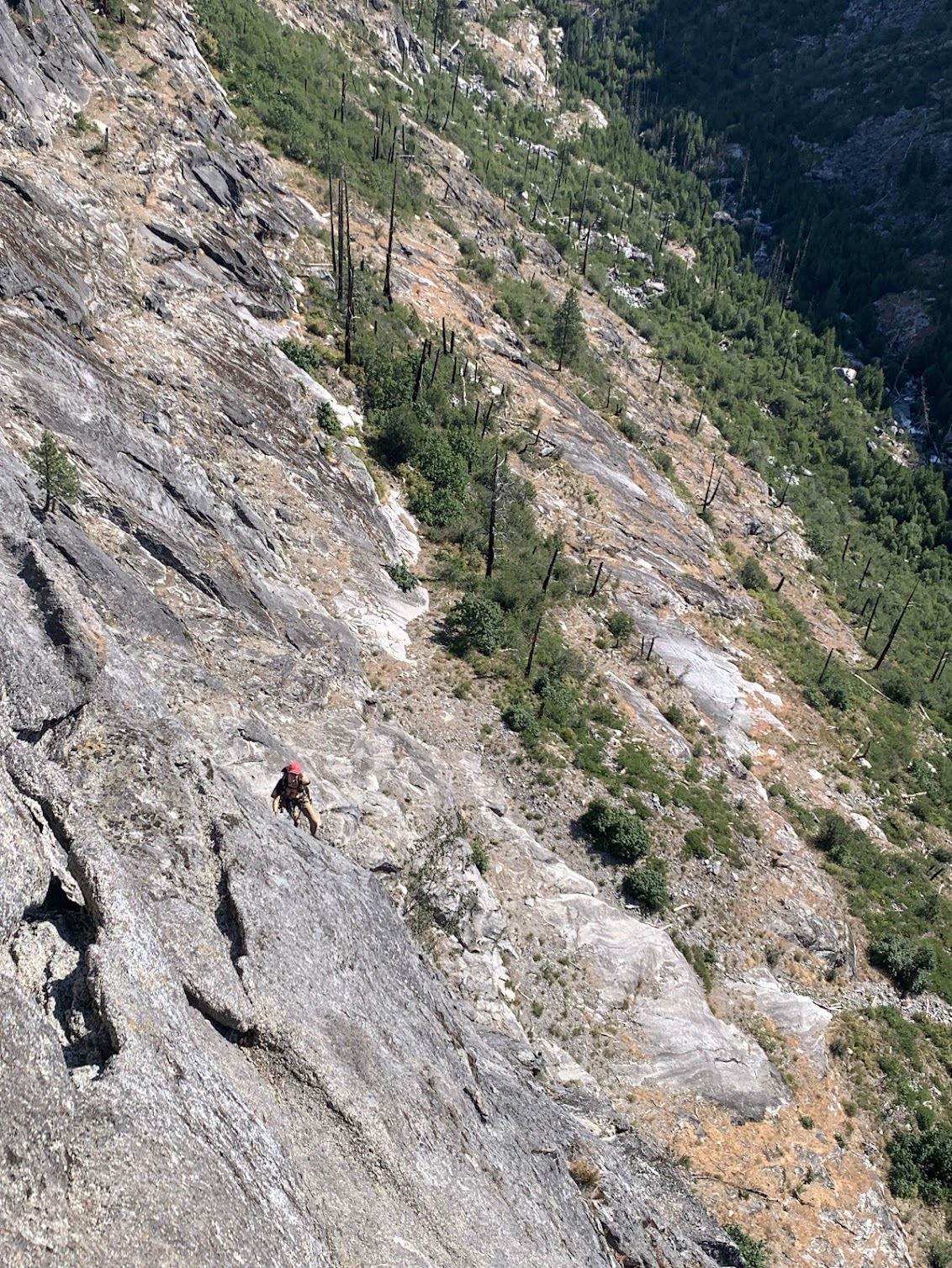
After a little walking past the colchuck lake turn-off, we reached the mountaineers creek climbers trail. It was our first time and we made the mistake of following the cairns to traverse the talus field. Then, we were too high and were stuck either schwacking through slide alder or climbing a few hundred feet above the slide alder. By now we were past our estimated approach time, and we still couldn’t see the ridge. We eventually made it up into the sherpa-argonaut basin, about 4 hours after leaving the car. From here we could see the notch we would gain to start the north ridge, and I think that’s when we all realized we were in for an epic. After more than a thousand feet of talus field climbing in the sun, we racked up and flaked the ropes at 11am.

Sherpa-Argonaut basin, with Colchuck(left) and Argonaut(right) in the skyline.
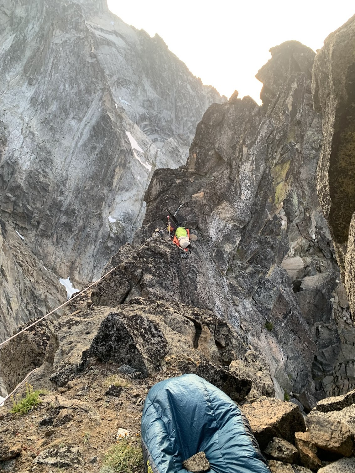
The first two pitches to get to the first notch were the technical crux of the route, but they allowed us to get our heads in the game and figure out the rope system for 3 people. From the ridge, we began a long afternoon of pitching out the ridge mixed with soloing and a little simuling. We found Lemke’s beta about getting to the second notch and by the time we got there, it was 6pm and we figured it would be the best spot to bivy. We were well behind schedule and doubted our chances of getting argonaut. With the sunset winds at full blast, we made our meals, did our best to shelter from the winds, and tried to doze off. Watching a party make their way up the West ridge didn’t help us get to sleep any faster.
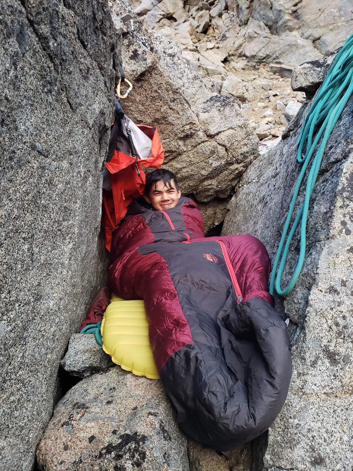
Cozy in my protected bivy
And Cole’s not so protected Bivy
At sunrise, we woke back up and got into a groove. The pitches from here were much better. While still licheny due to the routes rarely climbed status, it felt much more solid and after four hours, we topped out. With Stuart to the West and Argonaut to the East, it was beautiful summit.
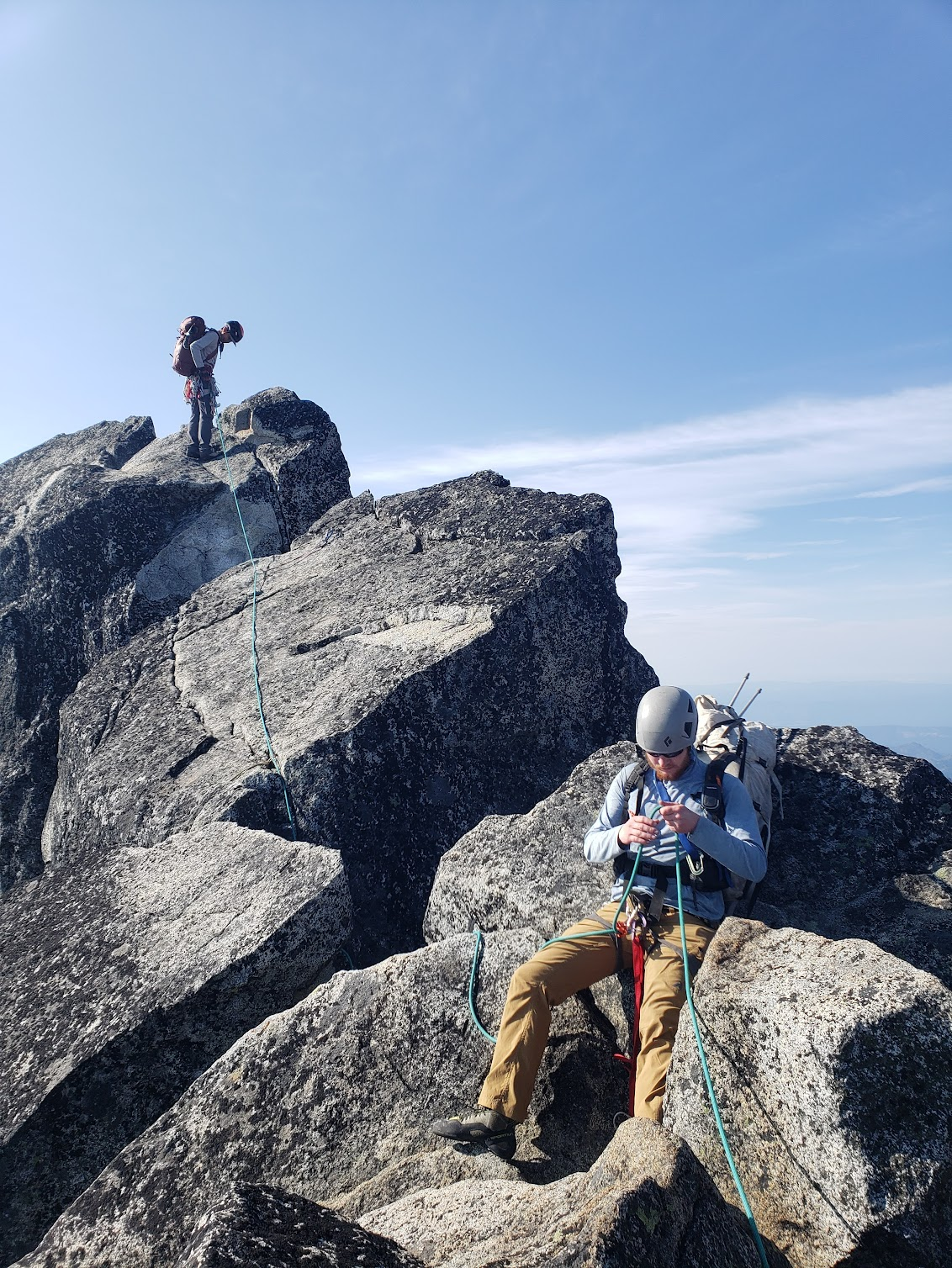
On the summit
The descent was the true crux of the route. We got to Lemke’s “cascadian esq gully” but after seeing the traverse we’d have to do, Cole gave us another option- descend into ingalls creek and follow the trail to us 97, where we’d hitch a ride back. After underselling us by 4 miles on the mileage, we were convinced and proceeded to schwack down to the creek. After 2 hours of talus descent and bushwack, we hit the trail around 2pm. This was when Emily checked the actual stats of the trail, about 9 miles of hiking plus 2 miles of road walk. We realized how fucked we were but there was nothing we could do, and proceeded to slog.

The Cascadian-esq gully
At 6, me and Emily came out far ahead of Cole, deciding to try and hitch a ride back so we could pick up Cole if he was unable to get one. We rode in the back of a truck to the highway, and then proceeded to fail to hitch a ride for 20 minutes. Eventually, we were picked up and were lucky enough to get a ride all the way back to forestlands. We met Cole in town, who had paid two crackheads to give him a ride, and enjoyed the experience of coming back from an epic adventure into the tourism center of Leavenworth, a stark juxtaposition every time.

No comments:
Post a Comment